Recent searches
Search options


#30DayMapChallenge  Day
Day 
 : Conflict
I figured a lot of mappers will create maps about recent wars and conflicts so I decided to create a map about #WorldWarI and see if #Wikidata is a good enough source for its battles, conflicts, and military operations.
I also wanted to know if there are any open data sources for historical borders, and I found one, CShapes! https://icr.ethz.ch/data/cshapes/
 1/2
1/2
” showing the national borders as of 1914 and with red dots pinpointing the location of the said battles")


@lavaeolus @seav Thanks. I remember cshapes had pre & post WWII maps but didn’t have any representing lines of control during war (e.g. after sept 1939) which was what I was going for. Still have a desire to create those if I can’t find em.
@markigra Maps like this?
From: The Palgrave concise historical atlas of the Second World War
https://archive.org/details/palgraveconciseh0000foll/page/n19/mode/2up
(Sadly no lat-long baked in... Makes georeferencing harder)

@lavaeolus Yes, that’s basically it. (Though mainly interested in lines of control not troop movements)
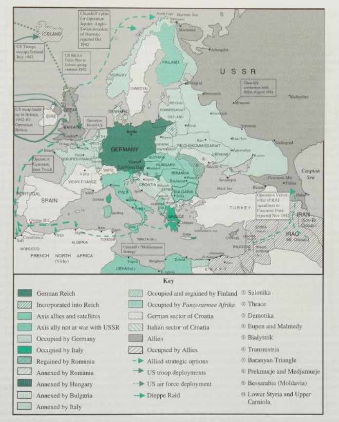


@lavaeolus Yes. That’s the kind of map. I’m interested in showing civilian movement in the context of occupation